|
Hold on While Loading Virtual Maps and routing ride # BR10-200k | |||||||
|
|
Comment/Story/Advice: 2010-01-03 10:55:02 Shai Shprung
from LA (san fernando valley), CA:
Jan 2nd 2010, the weather was excellent. My photos: http://picasaweb.google.com/shprung/200kFixed Another set of photos (by Jun Sato): http://picasaweb.google.com/gomtvasi/2010LA200k 2011-01-01 20:15:50 Shai Shprung
from LA (san fernando valley), CA:
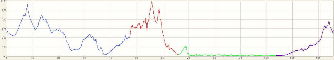
1/1/11 - nice date ;-) we rode the same exact route as 2010. It was cold (down to 32!) for many hours of the ride and less riders showed up (I assume the 1st and the cold had something to do with that). It felt like are riding into the wind all the time and we got just a short break at the last leg of the ride. It is a nice route so overall it was a very nice day. Stats: http://connect.garmin.com/activity/61495477 Post a Comment for ride #BR10-200k; Level 5; 125.5 miles
| ||||||||||||


